The Map That Doesn't Update: What I Learned Navigating Mongolia With Paper, Diesel, and Guesswork
Photo: Globetrotter19, CC BY-SA 4.0, via Wikimedia Commons
There's a moment on every Mongolian expedition when the blue dot on my phone gives up. It drifts, spins, then settles somewhere it absolutely is not — usually in the middle of a lake I can see with my own eyes two valleys over. That's when I fold the phone shut, unroll the paper map on the hood of the Russian van, and start doing it the way the herders have always done it: by landmarks, by sun position, and by asking the next person you see.
If you're an American used to Waze rerouting you around a traffic jam in real time, this will feel like a loss. Give it a week. It starts to feel like freedom.
Your GPS Is Lying to You (Politely)
Mongolia isn't unmapped — it's under-mapped. Satellite imagery shows faint traces of tracks, but tracks here are not roads. They're suggestions. A dirt route that existed three years ago may have been washed out by a summer flood, or the herders may have simply decided a better line exists half a kilometer east, and now everyone uses that one. Google never got the memo.
Worse, GPS in the steppe can be a few hundred meters off, which sounds trivial until you're trying to find a well, a pass through the hills, or the one bridge over a river that's otherwise knee-deep and fast.
So my kit looks like this:
- A 1:500,000 paper road atlas of Mongolia (available in Ulaanbaatar bookstores — buy two, you'll give one away)
- A compass, because when the steppe flattens out and the sky goes gray, everything looks the same in every direction
- Offline maps downloaded before departure, used as a rough reference, never as truth
- A Garmin inReach or similar satellite messenger — not for navigation, mostly, but for weather and the emergency SOS. More on that below.
The paper map is the backbone. I mark it in pencil as I go: where the fuel was actually available, where a family said the river crossing gets bad after rain, where I saw a valley at golden hour and need to come back with the camera.
The Real Navigation System Is a Herder
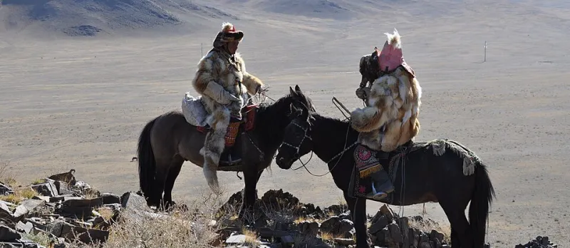
Here's the thing nobody tells you before your first trip: the most accurate routing software in Mongolia is a man on a horse.
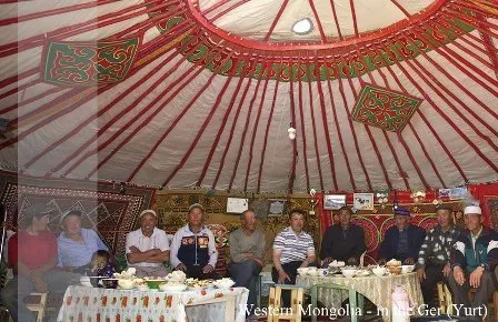
When you stop and ask directions — and you should stop often, it's half courtesy and half reconnaissance — you'll get an answer that looks like nothing. A gesture toward the horizon. "Two gers, then the ovoos, then the river, then left." No distances. No road names, because there are none.
And it works. Better than any app. These folks move across this landscape the way a New York cabbie moves through Manhattan — total, generational familiarity. When Batbayar says the crossing is bad, the crossing is bad. When he says it's four hours, it's four hours at his horse's pace, which means two in a van, or six if it's rained.
A few etiquette notes for asking:
- Approach on foot, unhurried. Don't drive right up to the ger door.
- Greet first — "Sain bainuu?" — and accept the offered tea if it's offered. Rushing the question before the milk tea arrives gets you shorter answers.
- Offer a small gift for real help: a good headlamp, batteries, or quality tea leaves go a long way.
- Ask about water and fuel, always, even if you think you're fine. "Fine" is a city concept.
Fuel Math in a Country With No Gas Stations
The rule I live by: half a tank is an emergency. If I pass fuel, I top off. Period. There's no such thing as too much diesel out here.
In the aimag (province) capitals you'll find actual stations. Between them, fuel comes from the back of a truck in a village, sold by the jerry can, quality variable. I carry a siphon filter and a funnel, and I've never once regretted the weight.
Do the arithmetic before you leave the last town, then double it. Distances on the map are straight lines; your actual route will wander around mud, riverbanks, and the herder's recommended detour. My Gobi crossing last spring ran about 40% longer than the map suggested. Every expedition vehicle out here carries extra, and the ones that don't are the ones you see flagged down on the track, waiting for a stranger with a spare can.
When to Say When: The Satellite Phone Question
Do you need a satellite communicator? Probably not. Should you bring one anyway? Yes.
I run a Garmin inReach because it's cheap relative to a proper satphone, the subscription is flexible, and the two-way messaging works fine for weather checks and check-ins with my fixer in UB. A true satphone (Iridium-based) buys you voice calls, which matters if you're running a bigger production or traveling with clients.
But here's the honest part: the device is insurance, not navigation. Nobody is coming to find you because your GPS is confused. Out here, self-reliance is the plan. The satellite messenger is just the difference between an inconvenience and a headline.
Why the Guesswork Is the Gift
A photographer friend visited from Montana last summer and got visibly anxious the first time we drove for six hours without a single sign, road number, or confirmation that we were on "the" route. By day three, he'd stopped checking his phone entirely. He was reading the country instead — the slope of the land, the direction of the herds, the smoke rising from a ger at dusk meaning someone's home.
That's what navigating Mongolia by paper map actually teaches you: attention. It's the same skill that makes a photograph work. You can't frame what you're not looking at, and you can't find a valley you can't name by staring at a blue dot.
So bring the map. Bring extra diesel. And when the phone dies — it will — wave down the next rider and ask. The answer will be a gesture toward the hills, and it will be exactly right.